
09 / RESEARCH / OBSERVATION & INTERPRETATION
Lunar Polar Rovers: From Ice Evidence to Usable Resources
Lunar ice is a scientific resource question before it becomes a settlement plan. Terrain, cold, power and instrument measurements determine how much a rover can establish about a promising polar site.
Permanently shadowed regions can preserve volatile material, while nearby illuminated terrain offers different operating conditions. VIPER is designed to investigate lunar water and its surroundings; mission plans are distinct from completed surface measurements. Orbital evidence does not establish a readily accessible reservoir at a proposed worksite. Abundance, depth, physical state and distribution must be measured, and extraction, storage and processing would require additional engineering demonstrations.
Cold traps and illuminated ridges
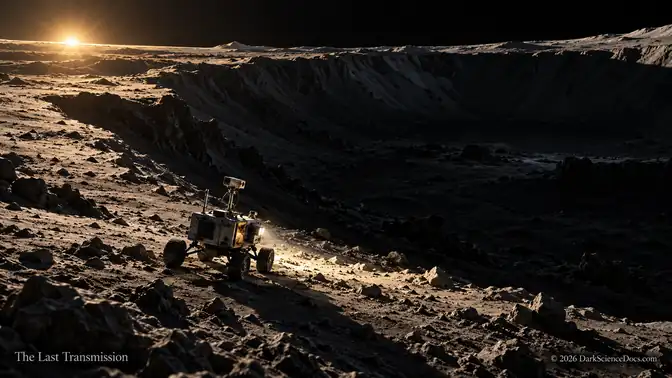
Near the lunar south pole, the Sun stays low on the horizon. Ridges can receive extended periods of illumination while nearby crater interiors remain permanently shadowed. Those differences turn the landscape into a complicated arrangement of possible power sources, cold traps, and difficult routes between them. A destination that looks close on a map can be separated from safety by terrain and darkness. [1] Inside some of those cold traps, water ice can persist because temperatures remain extremely low. The ice may preserve clues to how water reached the Moon and moved through the inner solar system. For mission planners, it also raises a practical possibility: perhaps future crews could obtain some of what they need locally, reducing the burden of bringing everything from Earth.
A rover must earn its traverse
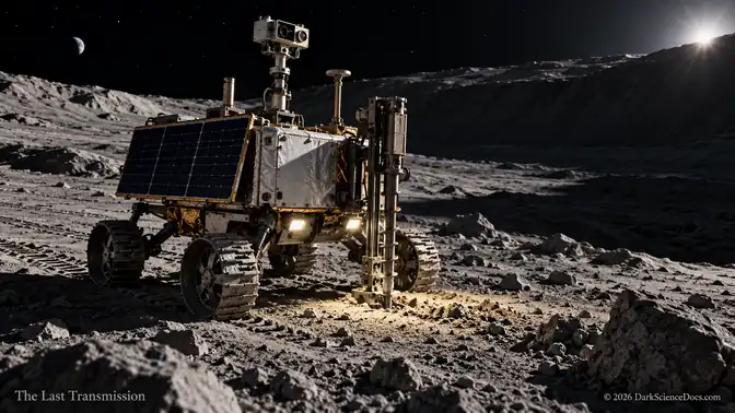
NASA’s VIPER rover is being prepared to investigate that gap between possibility and ground truth. Its name stands for Volatiles Investigating Polar Exploration Rover. NASA’s October 2026 update describes the vehicle as fully built and undergoing final testing at Johnson Space Center, with a planned traverse of more than 30 kilometers, or about 19 miles. Those are mission plans, rather than achievements already made on the Moon. [3] The route to that mission has already been uncertain. NASA canceled the earlier VIPER project in 2024, then selected Blue Origin in September 2025 for a delivery arrangement targeting late 2027 aboard the company’s second Blue Moon MK1 lander.
Hydrogen begins a longer investigation
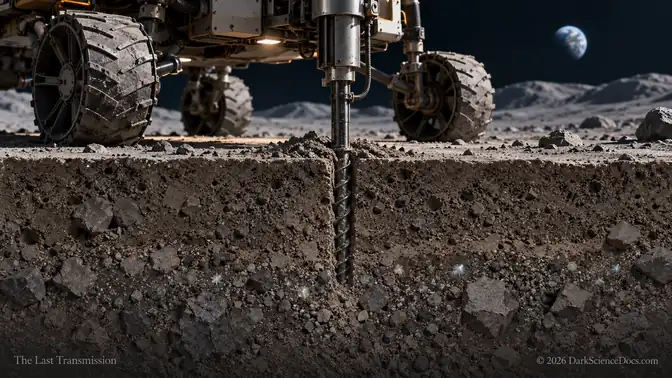
VIPER’s instruments are designed to build a case from several kinds of evidence. Its neutron spectrometer can detect changes associated with hydrogen beneath the surface. Hydrogen is part of water, but that signal alone cannot establish how much recoverable water a particular patch of ground contains. [5] At promising locations, the TRIDENT drill is designed to bring up material from as much as one meter, or about 3.3 feet, below the surface. A near-infrared spectrometer will help distinguish forms of hydrogen-bearing material and identify minerals and ices. A mass spectrometer will assess gases, including those associated with disturbed soil. Together, the instruments can reveal far more than a distant indication of hydrogen.
Read the illustrated companion article for the full narrative and its source trail. The selected passages above follow that article’s investigation.
Continue reading on SubstackTHE EVIDENCE / THE OPEN QUESTION
What we know.
Permanently shadowed regions can preserve volatile material, while nearby illuminated terrain offers different operating conditions. VIPER is designed to investigate lunar water and its surroundings; mission plans are distinct from completed surface measurements.
What remains open.
Orbital evidence does not establish a readily accessible reservoir at a proposed worksite. Abundance, depth, physical state and distribution must be measured, and extraction, storage and processing would require additional engineering demonstrations.
Why it matters.
Resource exploration connects geology with operational decisions. Measuring where water occurs can improve planning without promising that a particular deposit will sustain a base or make a mission economically practical.
COMPARE THE QUESTIONS
Follow what the light reveals.
Follow the relevant evidence and teaching models. Each model explains a mechanism and retains its own stated assumptions and limits.
FOLLOW THE EVIDENCE
Research behind the field note.
EXPLORE IN 3D / MAP 06
Explore the related science model
Resource exploration connects geology with operational decisions. Measuring where water occurs can improve planning without promising that a particular deposit will sustain a base or make a mission economically practical.
Open Earth & Moon mapVISUAL EVIDENCE
Inside the investigation.
FOLLOW THE THREAD
Related signals.
The Moon’s Darkest Places Could Decide Whether We Stay
NASA’s next lunar rovers must test whether ancient ice, dangerous terrain, and machines sent ahead of us can support something Apollo never attempted: a lasting human presence.
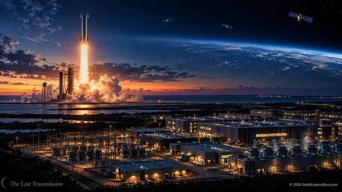
SpaceX Was Built to Reach Mars. Its Next Great Customer May Be AI.
Elon Musk’s selected update connects reusable rockets, a vastly larger Starlink network, and enormous computing campuses.

The First Humans on Mars Will Be Beyond Rescue
We are preparing to send people to another planet. But the greatest danger may arrive when someone calls Earth for help—and discovers that the answer cannot arrive in time.