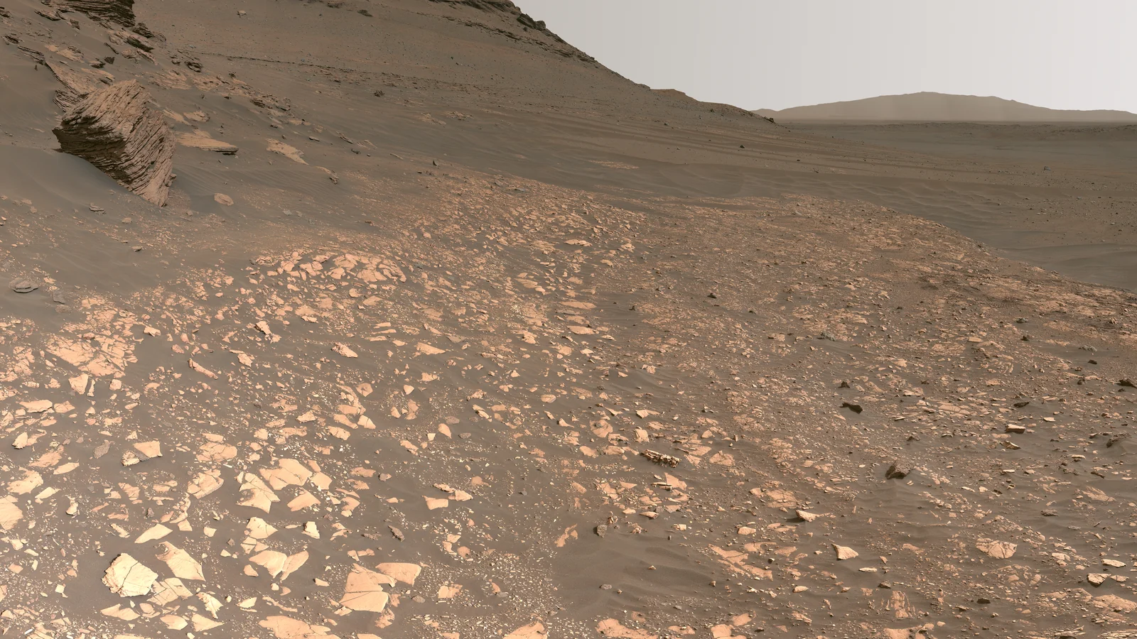
From orbit, Mars is a scarred planet. Down here, it becomes a landscape of individual stones, ridges, and questions. Drive a Perseverance model across a continuous, imagined Mars landscape, then step into three recorded panoramic observations.
Drive over textured soil toward Wind-carved Hill, Crater Overlook, and Dune Valley. The terrain is imagined from available imagery; it is not the actual surface of Mars.
Choose Begin exploration to load the scene.
Keyboard driving
Click inside the 3D view first, then use the arrow keys or WASD to drive.
Exploration distance
0.0 m
View mode
Drive / follow
Illustrated reconstruction. This surface is reconstructed from available imagery with imagined terrain added for exploration. It is not the actual surface of Mars, a mapped Jezero landscape, or a real rover route.
The Open Surface: on a phone, hold the arrows inside the viewer to drive or turn. On larger screens, use the driving buttons below the view. On desktop, click inside the 3D view first, then use the arrow keys or WASD to drive the rover. Drag to turn the camera; pinch, scroll inside the viewer, or use + and − to zoom. Switch off Following camera for an orbit view.
The three photo stops: drag left or right to look around each recorded 360° mosaic. Zoom in to inspect details. The camera stays in one place; there is no driving inside a photograph. Black patches are gaps in the original mosaic.
Select Hill, Crater, Dunes, Dust devil, or Giant dust devil to track a destination. Both columns drift slowly; their guides update as they move. The giant starts roughly 930 metres away. Use Traverse to cover the distance, and steer around rocks. Drag vertically to look up its towering column. Drive through its base and continue until the view clears. Pause dust freezes both whirlwinds while you keep driving. The guide reports direction and distance; a gold pointer marks visible ground at the target. It hides behind hills; the direction and distance guide stays available. Drive there using the arrows. The approaches to the landmarks are open; larger rocks elsewhere may require steering around them. Choose Inspect for a close look, Cruise to roam, or Traverse to cover more ground. These speeds and the distance counter belong to the illustration, not Perseverance’s real mission. Reset returns the rover and camera to their starting view. Movement stops when you leave the explorer or switch tabs.
WHAT THE SURFACE CAN TELL US
The image is evidence. The drive is an illustration.
The driving landscape takes its colors and surface character from available Mars imagery. The soil texture, dunes, craters, ridges, and rock arrangements are imagined to make one continuous world to explore. They do not identify actual locations or fill a scientific elevation map.
The rover’s position, speed, wheel motion, and suspension are simplified for exploration. Rocks are obstacles you can steer around. The three photographic stops are real observations from separate places and dates. Their viewing projection is approximate; no compass bearings are inferred.
Layered sediment helps reconstruct ancient environments. A photograph alone cannot establish that life lived there.
MARS WEATHER / INTO THE WHIRLWIND
A warm surface. A rising column.
Choose Dust devil for the nearby encounter or Giant dust devil for a darker column rising far beyond the landmarks. Follow its guide and drive through the broad, swirling base. Drag to look up; keep driving until the haze clears.
THE PHENOMENON
Dust carried into the sky.
Martian dust devils are rotating columns associated with rising warm air. They lift and redistribute fine surface dust. They are different from the powerful storm tornadoes familiar on Earth. Perseverance has photographed large columns in Jezero Crater; for one observed in August 2023, scientists estimated a width of about 60 metres and inferred a height near two kilometres from its shadow.
A dust devil passed directly over Perseverance in September 2021. Its microphone, camera, and weather sensors recorded sound, imagery, and a pressure drop. That is an actual observation. This explorer’s two columns, dust densities, and slowed drift are invented. Their displayed heights—155 metres nearby and eight kilometres for the distant giant—are chosen for the reconstructed landscape; the drive is an illustration, not a recreation of that event.
ESA’s June 2026 account describes Martian dust devils reaching up to eight kilometres—about five miles—high. The darker giant here illustrates that extreme scale, with a broad dusty foot and a curling, thinning upper plume. Its location, shape, lifetime, and density are imagined; it is not a surveyed vortex at Jezero.
A 2025 study tracked 1,039 dust devils in orbital images. The fastest moved at about 44 metres per second: 158 km/h, or 98 mph. Their travel across the ground traces the surrounding near-surface wind; it is not a measurement of how fast dust spins inside each vortex. The five-mile height and fastest wind are separate reported extremes, not measurements of one event. Mars’s thin air also exerts much less force than Earth’s air at the same speed. This explorer deliberately slows the drift so you can approach.
Martian meteorites demonstrate transport between worlds. The next question—whether living material could survive that journey—needs experiments and careful limits.
Compare Mars’s ancient water question with hydrothermal evidence from Earth’s Hapcheon impact crater. It is a separate terrestrial case, not a detection of Martian life.
Drive over textured soil toward Wind-carved Hill, Crater Overlook, and Dune Valley. The terrain is imagined from available imagery; it is not the actual surface of Mars.
The driving terrain is an imagined reconstruction inspired by NASA imagery, with a generated soil texture. The named landmarks and their navigation guides are illustrations, not surveyed features. The three panoramas are recorded NASA photographs resized for this explorer; their missing areas remain as captured. The photographic preview above is a detail from the delta mosaic. Rover appearance: NASA’s Perseverance model ↗.
The explorable landscape is invented from available visual references and is not the actual measured surface of Mars. Recorded rover panoramas serve a different role. Keep that distinction when using either view to ask questions about terrain or a real mission’s route.
Ask yourself Can I trace this claim to its evidence and understand the choices behind it?
THE SIGNAL CONTINUES
Some discoveries stay with you.
Get the illustrated investigations delivered to your inbox. Then follow the questions that refuse to leave.