A volcano that dwarfs mountains. A continent-spanning fracture. A delta that once carried water. Approach the surface, then follow the evidence.
CHANGE SCALE / MARS SURFACE EXPLORER
Descend to the surface.
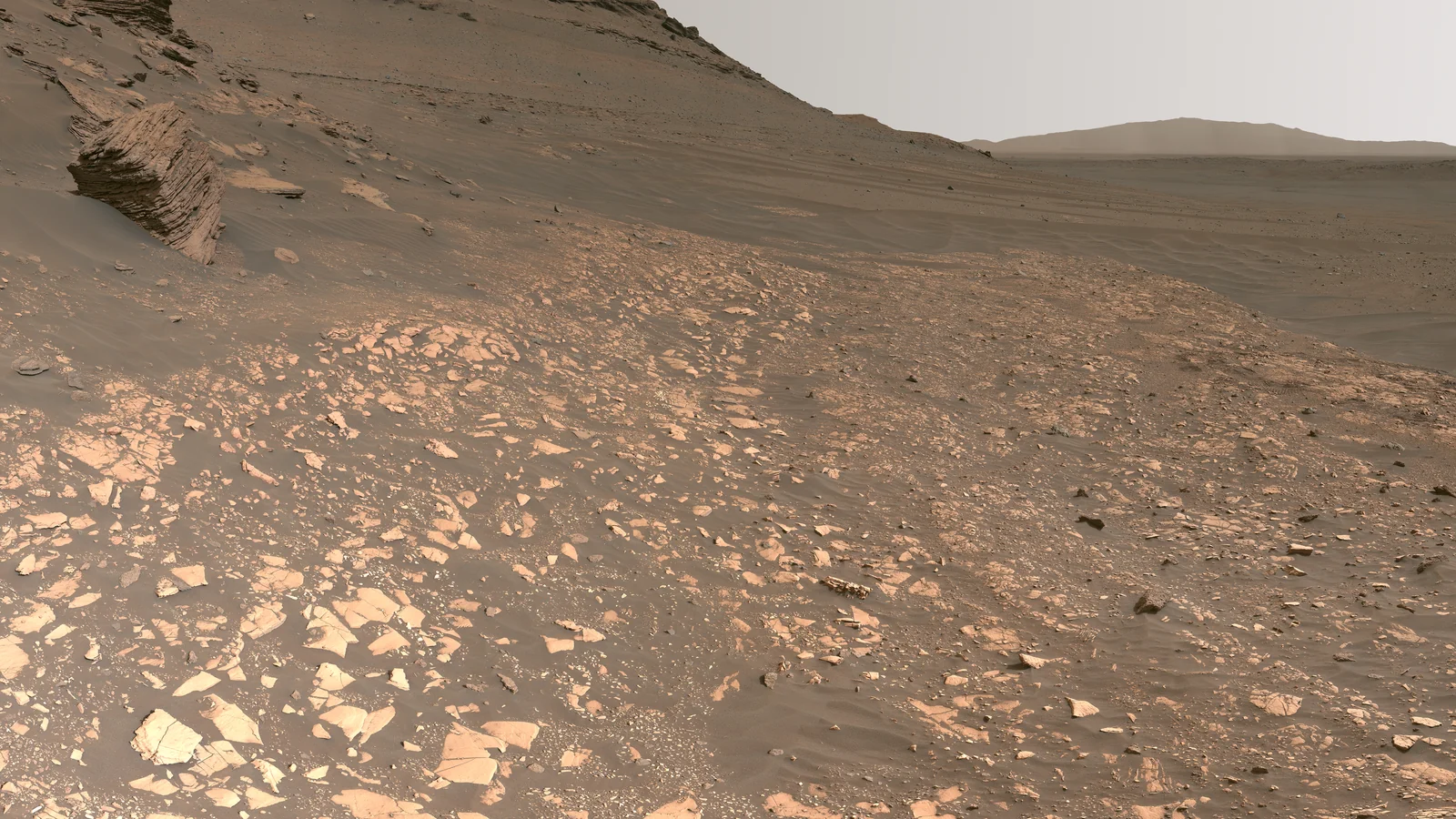
Drive Perseverance across an expansive, illustrated Mars landscape, then look around real panoramic photographs from the landing site, delta, and crater rim. A rock is a record. What would you investigate?
Select a destination. Drag to look around; pinch or use the zoom buttons.
DESTINATION 01 / MARS SYSTEM
Mars
The planet that kept its scars
What can the surface tell us about the interior?
Mars preserves volcanoes, canyons, impact scars, and old water-shaped landscapes. Orbital gravity and seismic measurements reach below that surface, but the global Viking image map in this scene cannot show subsurface heat or current activity.
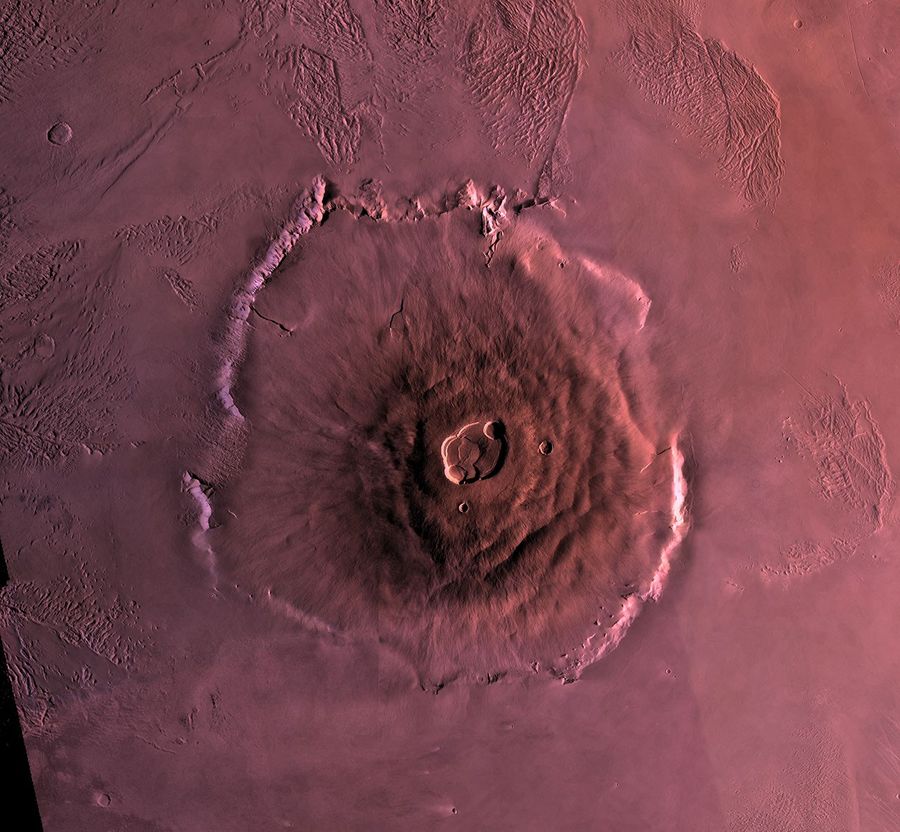
Olympus Mons is the largest known volcano in the solar system. Its vast shield records long-lived lava flows. The image below is a Viking Orbiter mosaic; the globe view shows the region, while the closer spacecraft view carries the detail.
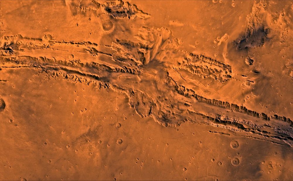
The immense troughs of Valles Marineris are commonly linked to crustal stretching and the rise of the neighboring Tharsis region, then modified by collapse and erosion. The close view below is a spacecraft mosaic; its sharp relief should not be inferred from the lower-resolution globe texture.
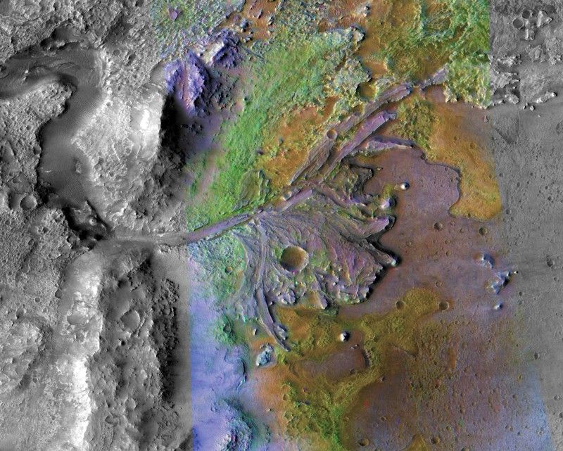
Perseverance landed in Jezero to investigate an ancient lake basin and river delta. Layers, minerals, and collected samples can test environmental history; they are not by themselves evidence that life once existed there. The color image below uses enhanced orbital data to expose the delta.
Enhanced-color orbital view of the Jezero delta, NASA/JPL-Caltech/ASU. Original NASA context ↗
What can a small moon reveal about impact history?
Phobos is the larger and closer of Mars’s two moons. Its Stickney crater and grooves invite competing interpretations of impacts, structural stress, and surface movement. The moon is deliberately enlarged here so that it can be explored.
Deimos is smaller and farther out than Phobos. Its surface looks smoother in many images because loose material partially fills craters. Its origin remains an open problem, and the pale map here is a compiled resource texture, not a current spacecraft view.
The globe uses a Viking-era image map processed by USGS and supplied by NASA/JPL-Caltech. Surface destination markers indicate approximate geographic regions; the map resolution cannot show rover-scale terrain. Separate NASA orbital views in the files give closer detail. The globe is a color image, not a MOLA elevation model. Moon sizes and positions are enlarged and arranged for navigation, not to scale or a live orbital simulation.
MMX will investigate how Phobos formed and whether its dust contains fragments ejected from Mars. Follow the mission, the sample-return plan, and the limits of the evidence.
A map records some regions more closely than others.
Surface views combine measurements with different resolution and coverage. A broad view can locate terrain without establishing every local detail. Follow the associated investigations when a claim depends on changes, composition, or conditions beyond the visible map.
Ask yourself How large are the uncertainties, and which claim would go beyond the data?
THE SIGNAL CONTINUES
Some discoveries stay with you.
Get the illustrated investigations delivered to your inbox. Then follow the questions that refuse to leave.