A world of impact scars, disappearing rock, ice in permanent darkness, and an unseen magnetic heart. Turn the map. Follow the measurements.
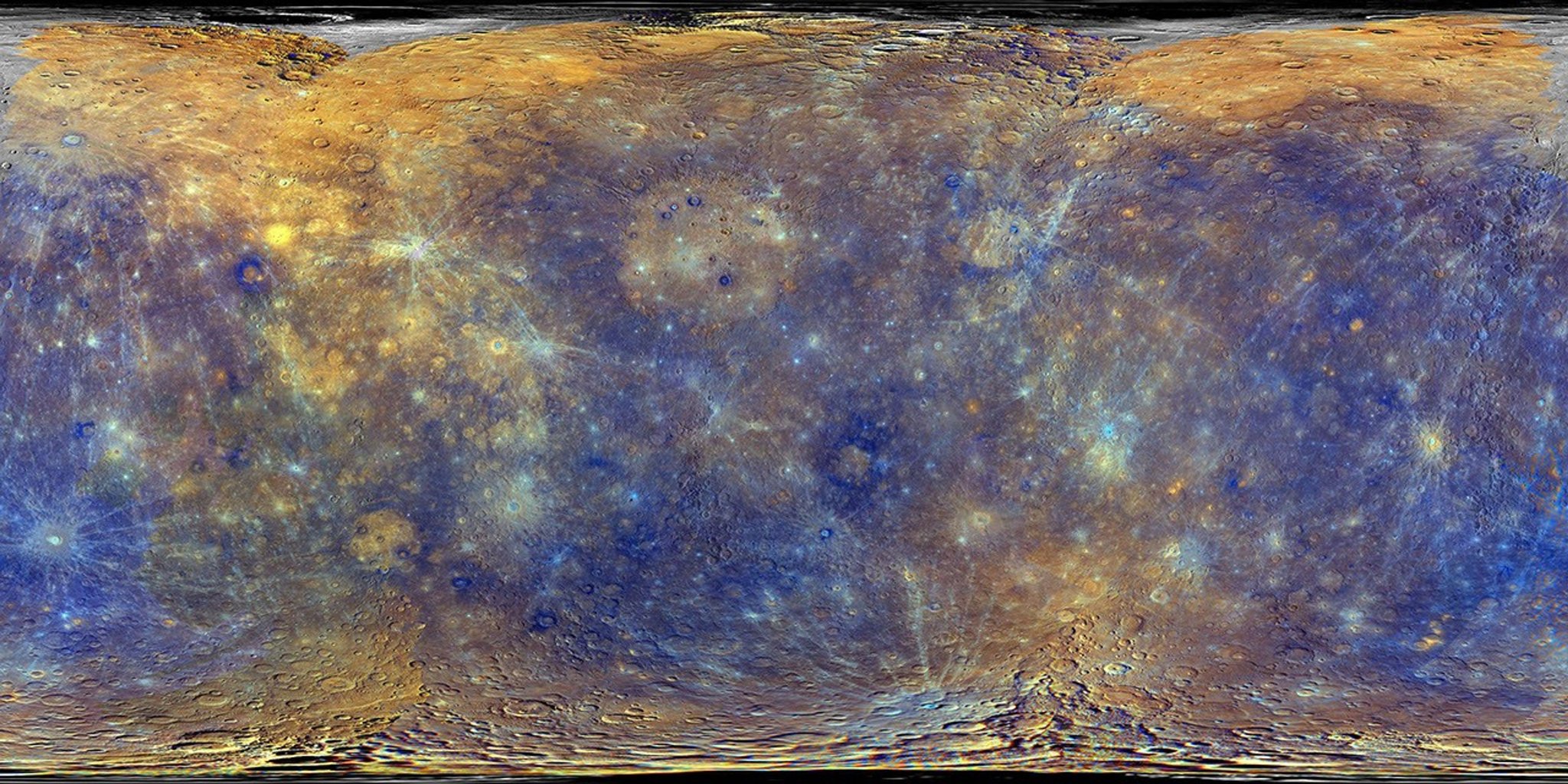
MERCURY / 11 MESSENGER ENHANCED COLOR · NOT NATURAL COLOR
Choose a research file. Drag to look around; pinch or use the zoom buttons.
FILE 01 / MERCURY
Mercury
The innermost world
What does a complete map change?
Mariner 10 left much of Mercury unseen. MESSENGER later mapped the whole sunlit surface and recorded its composition, gravity, magnetic field, and polar environment. The globe uses a real MESSENGER cylindrical mosaic. Its heightened blue, purple, and ochre colors reveal differences in the rocks; an astronaut would see a mostly grey-brown planet. Turn the globe to follow the impact record, then open the close observations below.
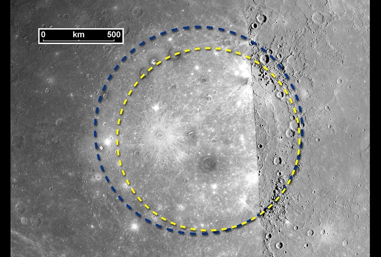
Mariner 10 saw only part of Caloris in daylight. The first MESSENGER flyby filled in the missing side and showed that its rim spans about 1,550 kilometers. The archival image joins two missions under different lighting; the seam is evidence of how the map was assembled. The impact made a basin, while later volcanic plains helped reshape its floor. This regional observation resolves far more than the global globe texture.
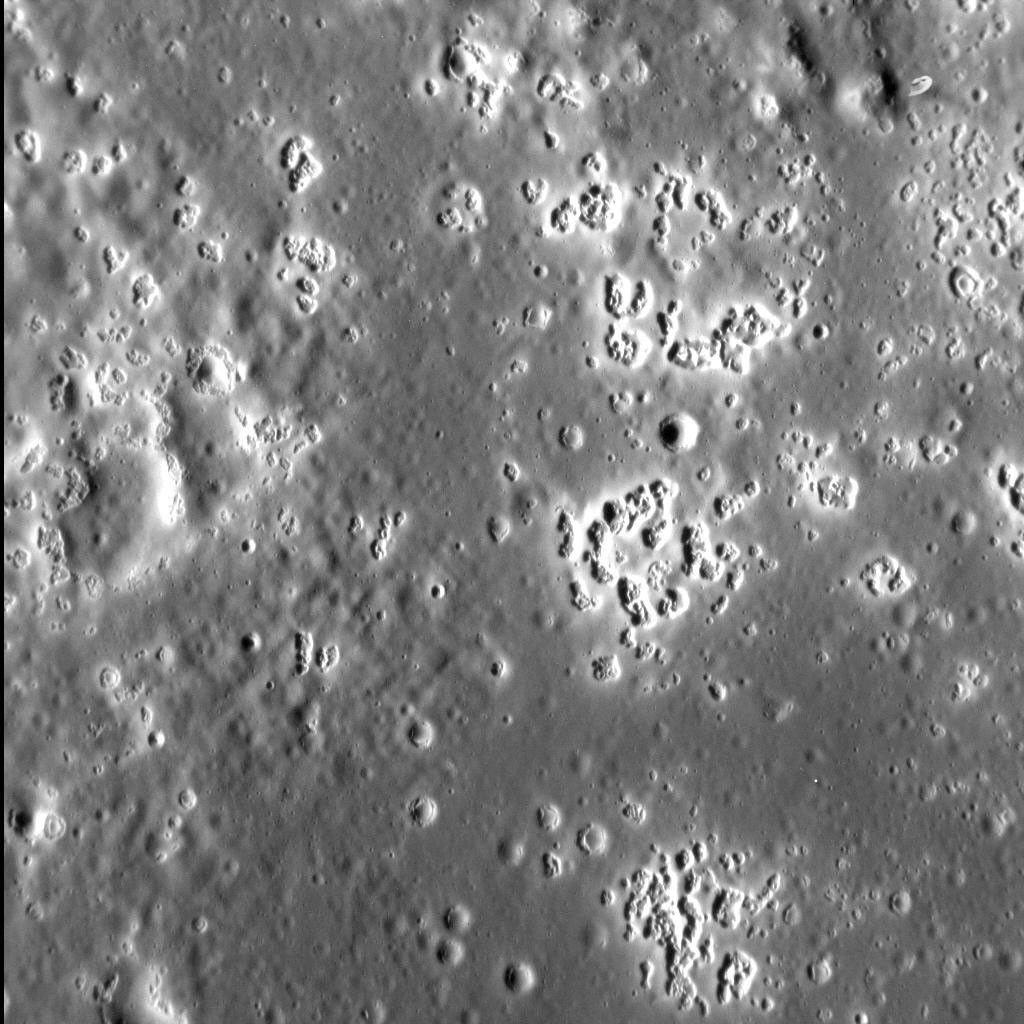
MESSENGER found clusters of shallow, bright depressions called hollows. This targeted image examines the floor of Zeami basin over an area about 20 kilometers across. Their association with exposed material raises the possibility that volatile components are being lost from rock at the surface. The process and its rate remain under investigation; no global map can show each small hollow at this scale.
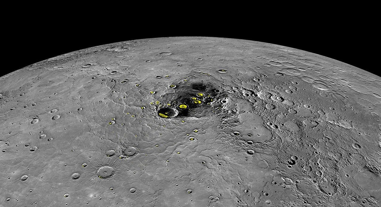
A sunlit surface can be fiercely hot while the floors of polar craters never see direct sunlight. Earth-based radar identified bright deposits in these shadows; MESSENGER’s neutron, reflectance, and temperature evidence strengthened the case for water ice. The yellow areas in this separate polar map indicate evidence, not visible yellow ice on the globe. The colored map is an observational overlay, not a live thermal view.
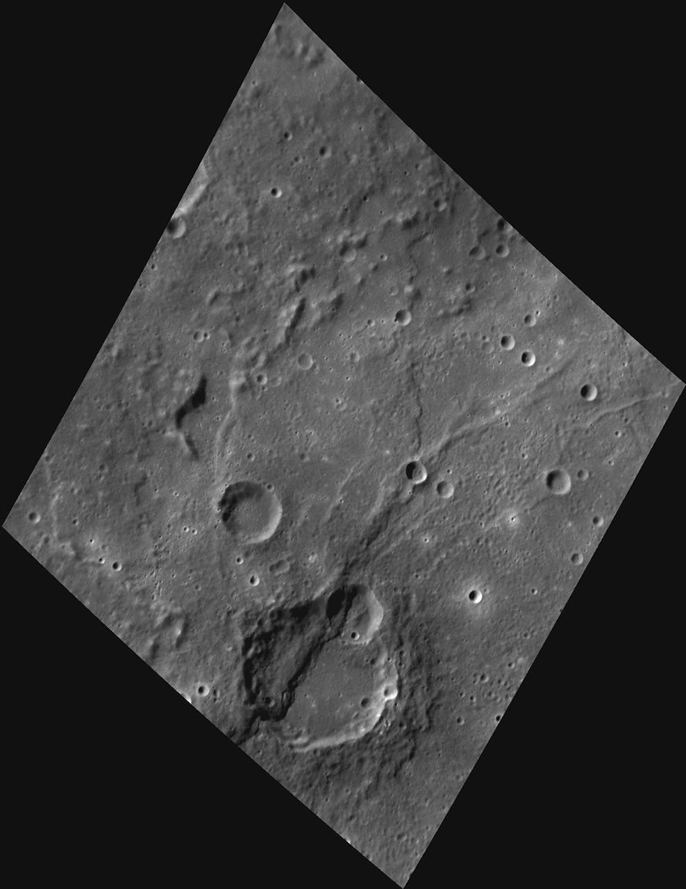
Mercury’s long, curved cliffs cut through older terrain and even cross crater floors. They are thrust faults: parts of the crust were pushed over neighboring rock as the planet’s interior cooled and contracted. This close image shows one such scarp. It documents the geology; the smooth globe does not exaggerate it into measured 3D relief. Whether all such deformation belongs to the distant past remains an open question.
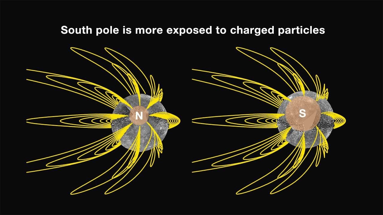
MESSENGER’s magnetometer measured an internal field with a striking north–south asymmetry. The field is evidence about electrically conducting material inside Mercury and about the way solar-wind particles reach its surface. The diagram below interprets measured field geometry; it is not a photograph, and the globe does not draw speculative field lines onto the terrain. The detailed structure of the core remains a research question.
The globe wraps NASA’s MESSENGER global mosaic onto a smooth sphere. Its colors are enhanced to expose differences in surface materials; they are not the view a human eye would see. Regional observations and the magnetic-field diagram are shown separately in their files. The globe texture cannot resolve individual hollows or polar ice deposits, and its sphere is not a topographic terrain model.
Camera flights, slow rotation, simulated sunlight, and stars are navigational illustrations rather than a spacecraft trajectory, current lighting, or live orbital simulation. The file buttons zoom into the globe but do not mark measured coordinates of the smaller features.
A map can locate craters, scarps, and polar regions. Claims about ice or interior properties use additional instrumental evidence. Follow the measurements behind each feature rather than treating the visible texture as support for every interpretation.
Ask yourself Do these sources contain separate measurements, or are they retelling the same result?
THE SIGNAL CONTINUES
Some discoveries stay with you.
Get the illustrated investigations delivered to your inbox. Then follow the questions that refuse to leave.