One spacecraft came through in 1986. Its rings came into view. Its moons revealed surfaces no one had imagined. Follow what Voyager saw, and where its maps end.
URANUS SYSTEM / 10 ILLUSTRATIVE PLANET · VOYAGER MOON MAPS
Choose a file. Drag to look around; pinch or use the zoom buttons.
FILE 01 / URANUS SYSTEM
Uranus
A planet turned on its side
What changed the direction of an entire world?
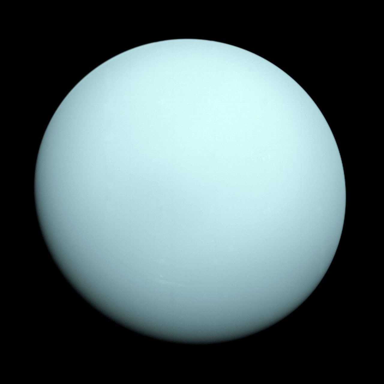
Uranus rotates with its axis tipped about 98 degrees relative to its orbit. Its long polar seasons and unusual magnetic field make the planet unlike the other giants. Voyager 2 remains the only spacecraft to have flown past it, in January 1986. The pale blue-green globe in this scene is a deliberately smooth illustration of the atmosphere, not a photograph wrapped around a complete planet. The separate Voyager image below shows the planet as the spacecraft recorded it.
Voyager 2 view of Uranus · NASA/JPL-Caltech · Source ↗
What happens when the ring plane follows the tilted equator?
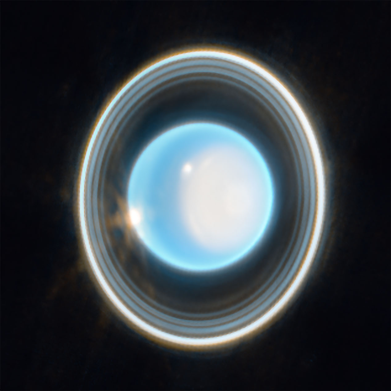
Uranus has narrow, dark rings aligned with its equator. Since the planet is so sharply tilted, the rings can present a dramatically different orientation to our line of sight over its long orbit. Webb recorded a bright, near-infrared view of rings and atmospheric structure in 2023; that representative-color observation is shown below. The thin loops in this viewer only suggest the ring plane. Their spacing, brightness, width, and orientation on your screen are chosen for clarity, not a measured reconstruction or a present-day view from Earth.
Webb NIRCam Uranus, February 2023 · NASA/ESA/CSA/STScI · Source ↗
Voyager measured a magnetic field whose axis does not line up neatly with the planet’s rotation. That geometry is evidence about where electric currents may be generated within Uranus, but no spacecraft has imaged the deep interior. Laboratory experiments on superionic water offer one possible piece of ice-giant physics, not proof that a particular layer exists at a known depth here. This file points from the measurement to the hypothesis without drawing unmeasured field lines or a speculative cutaway onto the globe.
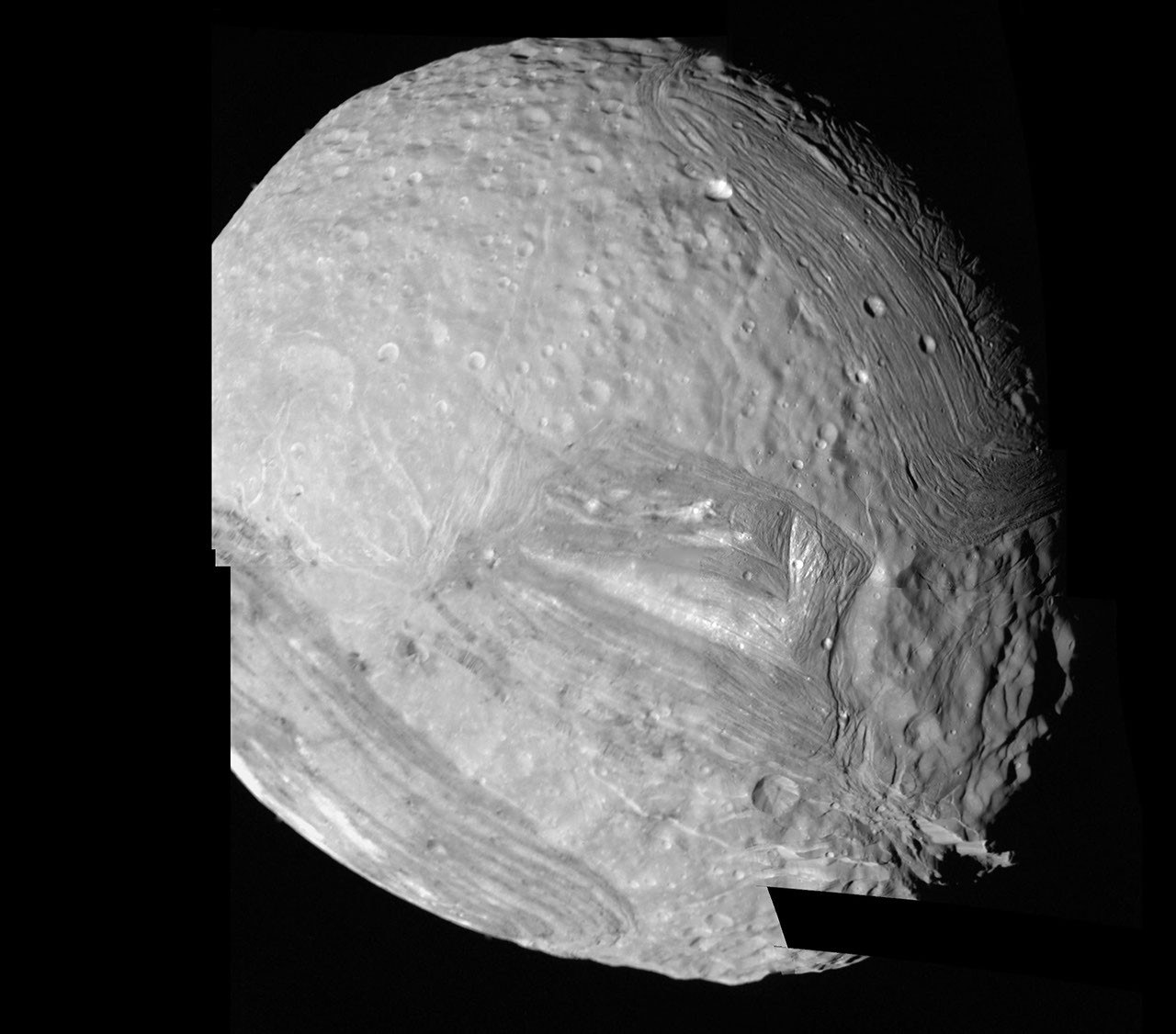
Voyager 2 returned extraordinary close views of ridges, grooves, faults, and large coronae on this small moon. These terrains touch at abrupt boundaries, preserving a complex history whose cause remains debated. The globe uses the Voyager-based grayscale mosaic supplied by JPL; its black northern regions mean missing image coverage. The larger archival mosaic below shows recorded terrain in detail. This smooth globe does not reproduce the cliffs as measured 3D relief.
Voyager 2 high-resolution mosaic of Miranda · NASA/JPL · Source ↗
What fractured Ariel after its oldest craters formed?
Voyager images show Ariel as a comparatively bright moon marked by fault valleys and areas that look smoother than its heavily cratered surroundings. Those contrasts suggest a history of geologic change, but one flyby cannot tell us when each episode occurred. Turn its grayscale Voyager mosaic here, then examine the agency account for the original observations. The dark part of the texture is unobserved terrain, not a dark surface measured by the camera.
Umbriel is the darkest of Uranus’s five major moons. Voyager found a heavily cratered landscape and a conspicuous bright ring near one feature, often called Wunda. Frost associated with an impact is a possibility, not a settled explanation. Its globe carries the Voyager-based southern mosaic and leaves the northern coverage gap black. The small image cannot settle the chemistry of the bright material or the age of the surrounding terrain.
Voyager 2 photographed Titania’s cratered surface and long fault valleys during the 1986 encounter. The fractures indicate that the icy crust changed after some older craters formed, but the history of its interior remains uncertain. Its JPL texture is a grayscale Voyager mosaic with black areas where the spacecraft did not map the surface. A smooth sphere can show the distribution of brightness and mapped structures, while it cannot turn this limited image record into a measured terrain model.
Oberon is heavily cratered in the images Voyager 2 returned. One prominent crater has a bright central peak and a notably dark floor. The scene uses Oberon’s Voyager mosaic from JPL’s original texture catalog. Its black northern region remains unobserved, so this model does not claim a complete map or a newly measured mountain.
The Uranus globe is a plain blue-green illustration informed by Voyager’s visible-light photograph, shown separately above. It does not map an observed global cloud pattern, a current polar cap, or the magnetic field. The near-vertical ring loops suggest the tilted equatorial plane but do not reproduce ring widths, opacity, radial spacing, or today’s viewing angle. Webb’s separate image is an infrared, representative-color observation.
The five moon textures are grayscale Voyager-derived mosaics from NASA/JPL-Caltech/USGS’s original map collection. Their black northern regions mean missing coverage, not dark land or permanent night. The spheres have no measured relief, and their sizes, positions, separation, lighting, and camera are arranged for exploration, not to scale or a live orbital simulation.
A view based on limited spacecraft coverage should not imply equally detailed knowledge of every region or moon. Ask which features come from imagery and which rely on interpretation. An unexplored-looking area is an evidence limit, not an absence of structure.
Ask yourself How large are the uncertainties, and which claim would go beyond the data?
THE SIGNAL CONTINUES
Some discoveries stay with you.
Get the illustrated investigations delivered to your inbox. Then follow the questions that refuse to leave.